Why get a survey?
Most people never meet the land surveyor that performs their survey. Surveyors play a large portion in every day real estate transactions. Along with a lot of other people behind the scenes trying to bring together an important step in your life…….the purchase of a house for your family, tract of land for investment or small parcel of land for a summer retreat.
Any person purchasing a piece of property should have their boundary corners and/or lines marked to lessen the chance of any disputes with the neighbors in the future. At times, this seems to be one thing that you wouldn't want to do, but to keep "peace" between landowners, it is best to know what is yours & what is not yours.
When being a "prospective" land purchaser, it's a good idea to talk to the adjoining owners, if possible, to get an idea of what they know about the property lines. This way, you can find out any possible problem areas which would aid in your decision of whether or not to get a survey done or to back off from the land purchase. If you decide to follow through with having a survey done, you begin your search for a surveyor to perform the work. This can be done by either talking with others that have had a survey done, the phone book & even the internet. After selecting your surveyor, he/she begins their work way in advance of going to the site by gathering the required information. They get copies of the current deed of record for the subject property & all adjoining parcels. This process is sometimes very time consuming to try to come up with descriptions of the property lines. Sometimes, we may have to trace back the property to it's original creation. The deed description is all the surveyor has to work with in doing the job. If an older survey plat is found, this is another tool for us to use in "retracing the surveyor's foot steps”. After finding all the information we can, we plot up all the deeds to create a rough drawing of the properties. The bearings, distances & old corner descriptions are written onto the drawing for the field crew to refer to during looking for evidence of property lines or corners. Locations are made of this evidence & compared to the deed calls to determine the exact location of property lines & the placement of missing corners.
Many times during my career I've seen neighbors "fall out" over just a few feet and even a few inches of property.
One such instance when 2 neighbors were "feuding"over a tree that each one claimed to be theirs. Upon taking the property line in the subdivision between them…….the tree (a 1" Maple) was "directly on" the property line. Now, because each neighbor had too much pride to admit to their wrong doing, or to apologize for their actions toward each other, they still don't speak to each other.
I enjoy my profession, but there are times that doing this type of work, you see the best of neighbors become enemies.
A suggestion to anyone making a land transaction is to get it surveyed. You'll have piece of mind & know for sure what is rightfully yours.
January 2022 by Greg A.
To better serve our clients we accept MasterCard, Visa, Discover, PayPal & Bank Debit Cards


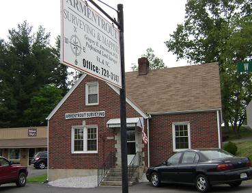
Our office is located at the corner of W. Stuart Drive & Locust St.
....or North Latitude 36°45'33"
West Longitude 080º44'19"
For a map & directions to our office:
Click Here

ARMENTROUT SURVEYING & MAPPING
Professional Land Surveyor in VA & NC